Have Queries? Fill in the form below & get the best deals.
Please enter a valid Email-ID
Please enter mobile number
Please enter Holiday Type
Please enter the destination
Please enter hub

Places to visit in Uttarakhand

Located amidst the mighty Himalayas, Uttarakhand is one of the prettiest places a person can visit in India. The state has the perfect setting for a lovely vacation where you can forget everything about the outer world and live in the lap of nature. Being a hilly region, a lot of activities such as trekking, camping, paragliding, and the likes are very famous here. In fact, Rishikesh, a small town in Uttarakhand, provides the best river rafting experience in India. You can spend your day here sitting on the banks of River Ganga and enjoy the enchanting view of the sun setting in the mountains.

Apart from being an extremely beautiful place, Uttarakhand is also a well-known pilgrimage site for the Hindus. People from every corner of the country come to Uttarakhand in order to visit places like Haridwar, Badrinath, Kedarnath, Gangotri, etc. You can also learn a lot about the local culture of Uttarakhand by observing the fashion sense, the food habits and religious habits of the residents. No one can get bored here as there numerous things to do in Uttarakhand.

Har Ki Dhun Trek

Information about Har ki Dun

Har Ki Dun is a valley of unparalleled beauty in the western part of the Garhwal Himalayas. It is famously known as the "Valley of Gods" because it offers a breathtaking view of snow-capped peaks and lush green meadows. The trek to Har ki dun starts at Sankri, nearly a 10-hour drive from Dehradun. The trek passes through ancient villages and rhododendron and oak forests, making it a truly enchanting experience.

The highlight of the Har Ki Dun trek is that it allows one to see unique flora and fauna. In this valley, one can find many rare animals like Bharal (blue sheep), birds, and wildflowers. The captivating view of snow-capped peaks like Swargarohini, Bandarpoonch, and Kala Nag makes it a popular tourist trekking destination.

One can indulge in plenty of activities while on the Har Ki Dun trek. One can go fishing in the nearby streams, explore the local flora and fauna on a nature walk, or play adventure sports like rock climbing and rappelling. There are cultural activities in which tourists can take part, such as visiting ancient temples and traditional villages. For a more spiritual experience, there are meditation and yoga centres in the area.

Location of 'Har ki Dun'

Har ki Dun is in the western part of the Garhwal Himalayas, in the Uttarkashi district of Uttarakhand. It lies between a range of snow-capped peaks like Swargarohini and Bandarpoonch at an altitude of 3,566 meters above sea level.

'Har ki Dun' Trek Guide

  • It is advised to stay well hydrated and carry enough water on your trek.
  • Carry a light backpack with essential items only.
  • Make sure you wear suitable trekking shoes and clothing for the cold weather.
  • Carry a first aid kit in case of any medical emergency.
  • Try not to step off the marked trails, and always follow your guide's instructions.
  • Enquire about the best time to visit the trek and plan your itinerary accordingly.
  • Carry an extra pair of clothes, warm clothing, sunscreen lotion, a torch, and ready-to-eat food items like energy bars, nuts, etc.
  • Keep yourself informed about the weather conditions at your destination and avoid trekking in bad weather.
  • Carry a power bank and keep your phone charged during the trek.
  • Stay away from loud music and disturbing other trekkers.
  • Do not litter on the trails and carry back any non-biodegradable waste.

Places to visit in Har ki Dun

  • Osla Village: Osla is a picturesque village in the Har Ki Dun valley. It serves as the base camp for trekkers and adventurers heading towards Har Ki Dun pass. The village offers breathtaking views of snow-covered mountains, clear streams, and lush green meadows.
  • Sankri: Sankri is a small village in the Garhwal Himalayas. It is the starting point for many treks, including the Har Ki Dun pass. There are plenty of opportunities for adventure activities such as rafting, trekking, and rock climbing near Sankri.
  • Taluka Village: Situated near the Har Ki Dun pass, Taluka village is a small but beautiful hamlet in the western Himalayas. This village serves as a base camp for trekkers and adventurers heading to Har Ki Dun pass.
  • Har Ki Dun Pass: Located at 3,800 meters, Har Ki Dun pass is one of the most popular trekking routes in the western Himalayas. It offers stunning views of majestic snow-covered peaks, lush green meadows, and pristine rivers.
  • Govind National Park: Govind National Park is in the Uttarkashi district of Uttarakhand. This park is home to a variety of flora and fauna, including leopards, Himalayan black bears, musk deer, and birds.

Activities to do in Har ki Dun

  • Trekking: The valley has a variety of trekking trails, ranging from easy to moderate ones suitable for beginners and experienced trekkers. The most popular trek is the Har Ki Dun Valley Trek, which starts at Sankri village and passes through enchanting alpine meadows, ancient forests, hidden waterfalls, and Himalayan glaciers.
  • Camping: It offers basic and luxury campsites where one can set up tents. The campsites offer breathtaking views of the mountains, lush green meadows, and snow-covered peaks. One can also enjoy activities like nature walks, bird-watching, and rock climbing in these campsites.
  • Village Tourism: In the Har ki Dun valley, one can explore different villages and get acquainted with their lifestyle, customs, and rituals. The most popular destinations include Osla, Seema, and Kalkatti.
  • Bird Watching: The area has a wide variety of species, including common ones like the Great Tit, Grey Wagtail, and Red-breasted Flycatcher, as well as rare ones like the Himalayan Monal and Lammergeier.

Highlights of 'Har ki Dun'

The mystical beauty of Har Ki Dun in the Garhwal Himalayas is unparalleled. The valley is a paradise for trekkers with its lush green meadows and snow-capped mountains. This moderate-grade trek offers breathtaking views of some of India's highest peaks, including Swargarohini Peak, Bandarpoonch, and Kala Nag.

The trek passes through dense forests of oak, pine, and rhododendron and stunning alpine meadows with spectacular views of snow-covered peaks. Along the way, travellers also visit small villages like Seema and Ruinsara Tal, where they can experience Garhwal's local culture and customs.

Weather in 'Har ki Dun'

The weather in the valley can vary greatly, depending on the time of year and altitude. In summer, temperatures range from cool to mild during the day and dip down too cold at night. During winter, temperatures can get quite low, with snowfall common from November through March.

Although it can get cold during winter, snowfall rarely interferes with trekking routes. The days are usually sunny, with cloud cover in the late afternoon and evenings. The average temperature ranges from 6–15 degrees Celsius (43–59 Fahrenheit).

Interesting facts about 'Har ki Dun'

  • Har Ki Dun is situated at an altitude of 11,800 feet above sea level and is one of India's most beautiful trekking destinations.
  • It has been popularised by many Bollywood movies over the years, including 3 Idiots and Jab Tak Hai Jaan.
  • The region is home to a variety of flora and fauna, including leopards, barking deer, musk deer, serow, and black bears.
  • Har Ki Dun is also considered the gateway to Garhwal Himalayas and is home to several high-altitude lakes, including Ruinsara Tal.
  • It is also an important pilgrimage site for Hindus as it is believed that Pandavas from Mahabharata visited this place during their journey to heaven.

Mythology related to 'Har ki Dun'

According to Hindu mythology, it is believed to be a mythical land visited by the Pandavas from Mahabharata during their exile. The story goes that Arjun and his brothers came here searching for peace and relaxation. They were amazed at the beauty of this valley, with its high peaks and green meadows. The Pandavas stayed here for some days and made many friends in the mountains.

It is said that during their stay in Har ki Dun, they prayed to Lord Shiva and Goddess Parvati, who blessed them with spiritual knowledge, strength, and courage to fight against the Kauravas in the great battle of Mahabharata.

Another story related to Har ki Dun is that it was one of the locations on Yudhishthira's Ashwamedha yagya. This yagya was done by Pandavas to prove their supremacy and strength.

History of 'Har ki Dun'

It was first discovered by British surveyors in 1884 during the Great Trigonometric Survey of India. The area has since become popular for its untouched natural beauty and is now a part of the Govind National Park.

For centuries, the mountain has been revered by locals as a sacred place. The name comes from two Kumaoni words, "Har," which means "snow," and "Dun," which means a deep valley. The area offers some of the most spectacular views in India, with snow-capped Himalayan peaks, green valleys and meadows, clear rivers, and pristine forests.

How to reach 'Har ki Dun'

Har ki Dun, located in the Garhwal region of Uttarakhand, can be reached by various means of transportation. The closest airport to Har Ki Dun is Jolly Grant Airport, located in Dehradun, about 224 km away.

One can also take a direct bus from Dehradun to Sankri, the nearest village to Har Ki Dun. The journey by road takes around 8–10 hours, depending on the traffic.

Alternatively, you can hire a taxi from Dehradun or Mussoorie to reach Har Ki Dun. It will take around 6–7 hours, depending on the traffic.

Another option is to take a train to Dehradun and then take a bus or taxi. This will take around 8-9 hours, depending on train timings and traffic.

Once you reach Sankri, you can hire a local jeep or car to reach the Har Ki Dun campsite, which will take around 4–5 hours. It is advisable to start early in the morning from Sankri.

Where/What to Eat in Har ki Dun

The most popular eateries near Har ki Dun include cafes, restaurants, dhabas (street-side eateries), small local shops, and tea stalls. Most of these restaurants and cafes serve traditional Indian cuisine, including dishes made with local ingredients. Some restaurants offer western-style food.

Local delicacies include the Garhwali Thali (a platter of traditional dishes), Bhatt Ki Churkani (flour dumplings smothered in yoghurt sauce), and Kaapa (a dish made with potatoes, spices, and yoghurt).

When travelling to Har ki Dun, it is also recommended to try the local tea stalls for a cup of herbal chai or masala chai. These tea stalls offer steaming hot cups of traditional Indian chai flavoured with saffron, ginger, cardamom, and other spices.

Information about the 'Har ki Dun' trek

The Har Ki Dun trek is a moderate difficulty level trek that lasts for 5 days. It begins at Sankri village in Uttarakhand, with the first day of the trek being an acclimatisation day. The trek then moves onto Taluka, Ruinsara Taal, Kalkatiyadhar, Har Ki Dun, and Osla before returning to Sankri.

The trek is a combination of easy ascent with some steep sections at times and provides a scenic view throughout. The trek also passes through ancient villages like Kalu, Seema, and Osla, which offer a fine insight into the traditional culture of the Garhwal region.

The trek culminates at the summit of Har ki Dun valley, also known as the 'Valley of Gods'. The view from this point and the descent are spectacular. It is said that one can catch sight of many snow-clad peaks, including Swargarohini I, II, and III (the mythological route to heaven) from here.

Where to stay in 'Har ki Dun'

Har ki Dun is a popular trekking destination, and several accommodation options cater to various budgets.

For luxury travellers, Camp Har-ki-dun by Himalayan Eco Lodges offers stunning views in an idyllic setting, with gourmet cuisine and comfortable rooms. The Snow View Hotel and Himalayan Resort are also great options for luxury travellers.

For budget travellers, there are various camping sites available in the area, as well as homestays and hostels. Popular budget accommodation options include the Base Camp Café & Homestay, which offers basic private rooms and dorms; The View Point Hotel, which offers basic rooms and dorms; and the GMVN Tourist Bungalow, a government-run guest house with rooms for budget travellers.

However, if you are trekking independently without an organised tour or guide, it is best to stay in homestays run by local families, as these offer great insight into the local culture and hospitality.

Why Har ki Dun is a must-visit?

Har ki Dun is one of the most beautiful places in Uttarakhand. It offers breathtaking views of the majestic Himalayas and stunning meadows, perfect trekking and camping opportunities. The area is also home to some rare species of flora and fauna, making it a great place for nature lovers. Har ki Dun is also known for its spiritual significance, as it has been a popular pilgrimage spot for centuries. The area is renowned for its ancient temples and shrines, which still attract visitors worldwide.

Apart from trekking and camping, Har ki Dun is an ideal place for bird watching with its wide variety of migratory and local birds. The stunning snow-capped mountain peaks, cascading waterfalls, crystal clear streams, and lush green meadows make it a perfect spot for photography enthusiasts.

In all, Har ki Dun is a must-visit destination.

Travel tips for 'Har ki Dun'

  • Carry a good pair of trekking shoes: Trekking in the mountains can be challenging and requires comfortable footwear. Make sure to carry a good quality pair of trekking shoes that will provide the best grip and support on uneven terrain.
  • Take enough water with you: As you will be walking through the mountains, it is important to stay hydrated. Make sure to take enough water with you on your journey and refill your bottles at regular intervals if needed.
  • Carry First Aid Kit: Don't forget to pack a basic first aid kit which includes bandages, antiseptic cream, painkillers, etc. This will come in handy in case of any injuries or medical emergencies during the trek.
  • Wear appropriate clothing: It is important to dress appropriately for the weather conditions. Make sure to carry light, breathable and layered clothing so that you can adjust according to the changing temperatures and weather.
  • Have a good sleeping bag: A good quality sleeping bag is essential for a comfortable night's rest during the trek. Make sure to invest in a good sleeping bag that keeps you warm and cosy when temperatures dip at night.
  • Carry a torch: A torch is a must-have item while trekking in the mountains. It is important to carry one with you to light your way while trekking in the dark hours.
  • Pack snacks: Don't forget to pack some energy bars, dry fruits, and other snacks that will help to refuel you during the trek. It is also a good idea to carry chocolates or candies for an instant energy boost.

FAQs

  1. What is the best time to hike Har Ki Dun Valley?

    The best time to trek to Har Ki Dun Valley is between April and October, as the weather during these months is pleasant and perfect for a leisurely walk in this beautiful valley.

  2. How strenuous is the trek?

    Har Ki Dun Valley is a moderate trek, ideal for beginner-level trekkers. Although the trek can get slightly strenuous at times, it is still considered easy compared to other Himalayan treks.

  3. How long does the trek take?

    The trek usually takes around 5–6 days to complete, depending on your pace and the weather conditions.

  4. What kind of accommodation is available during the trek?

    During the trek, you can stay in tents or homestays as accommodation facilities are limited. In some parts of the valley, campsites have also been set up.

  5. What kind of food is available during the trek?

    You can get a variety of vegetarian and non-vegetarian dishes. Snacks, such as momos, noodles, etc., can be bought at certain points during the trek.

Read More

Char Dham Yatra

The Char Dham yatra is considered to be the most auspicious pilgrimage in Hinduism. It is a religious journey to the four abodes of the gods that are most venerated by Hindus. Some believe that this yatra must be undertaken once every year as it helps to achieve “Moksha” (which means being freed from worldly concerns). It’s a great yatra for travellers too as all places are located in different parts of India.  

The shrines are at Yamunotri, Gangotri, Kedarnath and Badrinath. These are closed for visiting during the winters due to heavy snowfall and reopen only with the onset of summers. 


Highlights of the Char Dham yatra

It is believed that the Char Dham opens the doors of salvation by washing away the sins of the people who complete it. The four shrines associated with it are of great significance for Hindus and according to mythology, Shri Adi Shankaracharya attained freedom from the process of rebirth in the Badrinath Dham. 

The yatra is done in a particular sequence and begins with a visit to Yamunotri. Next in the sequence comes the Gangotri shrine and then the Kedarnath shrine. The final destination is the Badrinath Dham and here, the journey is said to be complete. 

Yamunotri Dham : Located at an altitude of 3164 meters from sea level, this is a shrine dedicated to Goddess Yamuna. It is believed that Yamuna was the sister of Yamraj who promised her that whoever takes a dip the Yamuna River will obtain salvation and will never be taken to Yamlok.

Gangotri Dham : The dham is located at an altitude of 3200 meters above sea level along the banks of river Bhagirathi. It is believed that the river Ganga sprang to life only after King Bhagirath meditated for a long time. This is why before visiting the beautiful temple, people take a dip in the river.

Kedarnath Dham : Kedarnath is one of the twelve jyotirlingas of Lord Shiva and the shrine is named after the Satyuga ruler ‘Kedar’. Kedarnath along with four other shrines are known as the Panch Kedar.

Badrinath Dham : It is the most sacred among the four shrines and is dedicated to Lord Vishnu who is the guardian of the divine Trinity (Brahma, Vishnu and Shiva). Located on the bank of river Alaknanda, it offers stunning views. What adds to the surrounding scenery is the fact that is 3,133 meters above sea level.  


Best time to visit Char Dham

Lakhs of devotees and pilgrims flock to Char Dham every year as it is the holiest circuit for them. The best time to visit is during the months of May to October. One must not visit during the monsoon as the area is prone to landslides. Heavy snowfall happens in the Garhwal Himalayas during the winters and the gates of the shrines are closed for the entire duration. The idols in the temples are shifted to nearby pilgrim sites, and though devotees can visit them, the shift in location stops its from being a part of the Char Dham circuit.

Get in touch with your spiritual side by taking the Char Dham Yatra. Book your tickets through our website today! 

Read More

Kumbh Mela

The Kumbh Mela is the biggest religious festival on the planet. Hindus from all over the country look forward to this festival where pilgrims from every corner of India gather at a particular place and worship their god. The Kumbh Mela has been taking place from time immemorial and is the world’s largest congregation of pilgrims. It takes place every third year and the location of the festival is rotated among four cities, Haridwar, Allahabad, Nasik and Ujjain, turn by turn. The festival returns to the same city in every 12 years, but in Haridwar, the festival takes place in every six years. According to Hindu mythology, the Kumbh Mela is organized to provide a long and happy life to all the pilgrims who visit the festival. This festival is so huge that over 120 million pilgrims had attended the festival on its last occurrence, which lasted for about two months.


Date: It takes place on every 6th year in Uttarakhand and the exact date is calculated according to the Sun’s, Moon’s and Jupiter’s combination

Location: Haridwar

Read More

Basant Panchami

Uttarakhand, previously called Uttaranchal, is a state in the northern region of India. It is one of the most beautiful holiday destinations in the country, known for its impressive natural landscapes. Tourists from all over India and the world visit Uttarakhand for its beautiful waterfalls, lakes, hill stations, lush greenery, etc. Besides its natural glory, the state is a popular spot for wildlife watching and adventure activities. In addition, the unique regional culture and traditions of Uttarakhand play a major role in boosting its tourism. Individuals often refer to Uttarakhand as “Devbhumi”, which translates to the “Land of the Gods”. It got this name due to the presence of numerous prominent Hindu temples and pilgrimages sites spread across the region. 

Religion not only steers the attention of thousands of devotees to the region but also has a massive influence on its local culture and traditions. Fairs and festivals are a frequent occurrence in Uttarakhand, mostly ranging between the themes of religion and culture. For instance, the Kumbh Mela in Uttarakhand’s Haridwar is one of India’s biggest and most important Hindu festivals. It takes place once every 12 years and attracts millions of tourists and devotees from all over the world. Other major festivals celebrated in Uttarakhand include Holi, Makar Sankranti, Phool Dei, Vat Savitri, Ganga Dussehra, Purnagiri Mela, etc.

Among the several festivals celebrated in Uttarakhand, Basant Panchami is one of the most important ones. It is a famous festival celebrated by Hindus, Jains and Sikhs in India, as well as in various other countries. The festival has a different significance to people of different faiths and is widely observed throughout the state. During this time, the whole region wraps itself into a grand festive mood and celebrates Basant Panchami in the most unique way. It is not only a major tourist attraction in Uttarakhand but also a great time to visit the state to observe and learn more about its religious, cultural and traditional side. You can find all the crucial details about Basant Panchami in Uttarakhand in the following points.

About Basant Panchami in Uttarakhand 

Basant Panchami in Uttarakhand is also referred to as Vasant Panchami in some regions. Celebrating this grand festival commemorates the arrival of the Basant Ritu or spring season. It also marks the end of winter, which is seen as a month of death and rot. The festival usually takes place early in the first quarter and is said to also mark the beginning of Holika and Holi preparations, which is marked 40 days after it. The festival is centred right in the transition period, when the chilly winter winds slowly pan out, and the sweet spring starts to bloom with all its glory. The colourful Basant Panchami festival is often referred to as Sripanchami in some areas.

While other regions in India also celebrate this festival in their way, Uttarakhand’s take on Basant Panchami is quite unique. The best part about Vasant Panchami in Uttarakhand is that every member of the household, from children to the elderly, participates in the celebrations. Making colourful decorations, wearing traditional clothing, performing regional dance and music, doing fun activities, hosting family gatherings, etc., are just some of the main features of this festival. The worshipping of gods and goddesses (Pujas) is also a significant aspect of the Basant Panchami celebrations in Uttarakhand. It is more than just a festival centred around fun and merrymaking and has crucial religious and cultural significance to the people of the region.

Significance of Basant Panchami in Uttarakhand

Alongside marking the end of winter and the beginning of spring, the Hindu deity, Goddess Saraswati, is worshipped on the auspicious occasion of Basant Panchami in Uttarakhand. According to Hinduism, she is the goddess of music, language, knowledge and all forms of arts. Goddess Saraswati symbolises true creative thinking and energy, alongside love and longing, and is immensely respected by the people of the Hindu faith. Hence, individuals across Uttarakhand pray to her during Basant Panchami, or Vasant Panchami, to seek her blessings and excel in the fields of education, music, art and so on. People worship her so she can grant them a wealth of knowledge, which is considered the most powerful weapon for humans. Hence, the festival has a major significance for the Hindus in Uttarakhand.

With Goddess Saraswati, people even worship Lord Shiva, Devi Parvati (as the mother earth) and agriculture or crops during the occasion of Basant Panchami in Uttarakhand.

How is Basant Panchami celebrated in Uttarakhand? 

The people of Uttarakhand welcome Basant Panchmai with grand celebrations. As the flowers start to bloom and the sun's rays become more pleasant, the air surrounding the region echoes the melodious beats of drums. As the season also marks the ripening of agricultural lands with yellow flowers of mustard crops, the colour yellow gets widely associated by the Hindus as the favourite of Goddess Saraswati. Hence, individuals across the state dress up in traditional yellow clothing, with yellow tilaks gracing their foreheads. The same theme is seen within the house decorations and festive delicacies, offering a bright yet soothing tone to the occasion. The celebrations also include the performance of various traditional dance forms, like Jhumelia and Chounphula. All family members and relatives gather together and indulge in various merrymaking activities.

The worship of Goddess Saraswati is seen across various localities, households and educational institutions. Prasadams get distributed among people, while local dance and music events grace every nook and corner of the state. One of the best places in Uttarakhand where you can enjoy the celebrations of Basant Panchami in all its glory is Rishikesh, about 45 kilometres from Dehradun. The city hosts a grand fair dedicated to Basant Panchami within the bounds of the famous Bharat Temple. Thousands of individuals from all over the state attend this grand fair to witness the festival celebrations and the local traditions. Alongside the fair, a big procession takes place where Lord Bharat’s idol is carried through the city while devotees stand by the roadside to catch a glimpse of the god. The main reason behind this tradition is that the Idol of Lord Bharat was installed by Jagat Guru Shankaracharya on the auspicious day of Basant Panchami. Rishikesh is also one of the best places in the state where you can learn about the history of Basant Panchami. In some localities in Uttarakhand, individuals celebrate the occasion by flying colourful kites and preparing sweet rice at home. 

When is Basant Panchami celebrated in Uttarakhand? 

Basant Panchami in Uttarakhand is generally celebrated in the early first quarter of the year. It is right between the end of the winter season and the onset of springtime. According to the Hindu Lunisolar calendar, Basant Panchami takes place on the fifth day in the month of Magha. The date varies as per the English calendar, usually falling between the months of January and February. As Spring is considered the “king of all seasons”, the festival of Basant Panchami gives credence to the idea of spring coming in full bloom after 40 days. In the year 2023, the festival was celebrated on Thursday, January 26th. As for the date in the year 2024, Basant Panchami in Uttarakhand is going to take place on Wednesday, February 14th.

Read More

Dandeli

Dandeli is a fascinating and adventurous city situated on the Western Ghats in Uttarakhand popular for its lush dense deciduous forests, deep valleys, wildlife sanctuaries, bird watching, water sports, river side fishing, trekking on hilly terrains, mountain biking, night camps and scenic beauty. It is a mélange of astounding nature and exhilarating adventure that allures vacationers, making it a top tourist destination.

The best season to visit Dandeli is between October to May when the climate is pleasant for the water and other activities and also to spot the animals. Monsoons is best avoided due to heavy rainfalls making it unsuitable to enjoy the spots.

Location

https://www.google.co.in/maps/place/Dandeli,+Uttarakhand+249146/@30.3126298,78.4664002,15z/data=!3m1!4b1!4m5!3m4!1s0x39091cb4d34f487b:0xefc1d674ac6a9a54!8m2!3d30.3117573!4d78.4766152


Some of the prime attractions are:

1.Kavala Caves - The exotic limestone Kavala caves is visited by tourists and especially by devotees of Lord Shiva to see an incredible creation of shivlinga formed by the volcanic activities. The cave is adorned with stalactites and stalagmites and to visit the inner sanctum one has to descend down 375 steps and carry a torch as the cave is pitch dark.

Timings: 8:00 am to 5:00 pm Daily.

2.Shiroli Peak – The highest peak in the Dandeli Wildlife Sanctuary, it offers a glorious view of the Western ghat’s Sahyadri range, picturesque sunset and is a good route for trekking as well. An ideal spot for nature and adventure seekers.

3.River Kali – River Kali offers a myriad of water activities, attracting majority of the adventure enthusiasts to Dandeli. Mercurial in nature, it caters to the excitement for both amateurs and professionals. White water rafting in Kali river is an enthralling experience of rafting through grade 2, 3 and 4 rapids over a 9 kilometer run under the supervision of an expert. Besides rafting, kayaking and canoeing are other activities that one can indulge in. Coracle boat riding, a saucer-shaped ‘boat’ made of bamboo and tanned buffalo hide is a beguiling experience to watch crocodiles in the water, and hornbills hovering in the sky. Moonlight boating is another activity for nature lovers to ride at night with night vision binoculars to see the nocturnal animals in the surrounding jungle which is home to deers and boars amongst others.

4.Kayaking - Kayaking activities are conducted in the Supa reservoir, which is a man-made reservoir that spreads over a huge area surrounded by teak plantations. There are small islets in between where one can camp in absolute privacy since the entire area is uninhabited.

5.Canyoning-  Canyoning is a variant form of rappelling conducted in the Sathkonda Canyon near Dandeli. A challenging activity, it is the current rage and an adrenaline pumping experience of rappelling down steep rocks under the gushing waterfall (safety harness attached) using a combination of jumping, abseiling and natural water slides.

6.Rappelling -  Climb the steepest rocky cliffs of Sahyadri mountains and careen down suspended on a rope. A thrilling activity conducted under the supervision of an expert, it is a must.

7.Wildlife Sanctuary – In an area of 834.16 sq km, it is second largest wildlife sanctuary in Karnataka and was declared as one in 1956. Dandeli Wildlife Sanctuary offers a plethora of excitement for nature lovers and adventurers:

8.Flora - The entire forest area is covered with thick vegetation punctuated with bamboo and teak plants.

9.Fauna- Visitors are likely to spot tigers, leopards, sloth bears, Malabar giant squirrels, barking deers, elephants, bisons, black panthers, Indian pangolin, Indian jackal, etc.

10.Birds – A haven for bird watchers, it is a thrill to see pied hornbills, bar winged flycatcher shrikes, crested serpent eagle, pompadour green pigeons, kingfisher, woodpecker, cuckoo, blue headed ground thrush, yellow browed bulbuls and many more.

11.Jungle Safari and Trekking – Explore the vast sanctuary in an open jeep safari, trekking on foot or mountain biking and feel the rush of spotting the wildlife amidst the lush green forest.

12.Camping – Indulge in overnight and outdoor camping for a different experience. Sync with nature as you camp at the banks of river Kali under the stars and with a spectacular view of the resident birds hovering in the sky.


Highlights

  • Dandeli is an ideal destination for engaging in myriad of water sports such as white water rafting, kayaking, canoeing, coracle boat riding etc.
  • Bathe in the river Kali’s rapid’s that provide an effect of a natural Jacuzzi bath.
  • The Wildlife Sanctuary is a paradise for bird watchers as it’s a residence for diverse range of bird species especially the Malabar Pied Hornbill.
  • It offers an exciting opportunity to sync in with nature by camping amidst the luxurious verdant forests and wildlife.
  • The Syntheri Rocks close to the Ulavi temple is a must visit site to witness a massive structure of imposing rocks made of granite. A sheer breathtaking sight to behold.
  • The Shivaji fort 22km away from Dandeli warrants a visit. Built by Chhatrapati Shivaji, it boasts of ingenious warring techniques and strategies implemented by the warriors to win wars and protect the fort.
  • Skyes point – 23 km from Dandeli, is famous for the spellbinding views of river Kali and lush green topography during the mesmerizing sunset.


Recommended For

An ideal retreat for an exciting adventure packed holiday amidst lush evergreen nature.


How to get to Dandeli

Flight: The nearest airport is Belgaum Airport, Karnataka about a distance of 90 km. A cab can be hired from there directly to Dandeli.

Train: The closest station is Alnaver railway station at a distance of 35 km. A cab can be hired from there directly to Dandeli

Road: Dandeli is well connected to major cities of India and several private and state buses ply to to the city. Private car and taxi can also be hired.


Interesting Facts About Dandeli.

A local legend states that the city is named after Dandelappa, a local deity, a servant of the Mirashi landlords, who lost his life because of his loyalty. An alternative legend states that a king named Dandakanayaka passed through the forests and named them after himself, and the city is believed to stand on the place where Dandakaranya stood when he named the area.


Read More

Valley of Flowers

Information about the Valley of Flowers:

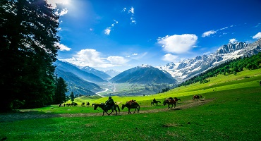
The heavenly beauty of the Valley of Flowers region is renowned for its alpine meadows with vibrant flora and fauna. This pristine region is home to some of the Himalayan's rarest flora. It attracts many botanists, explorers, nature lovers and avid hikers. In addition to endangered species of medicinal plants, you can see different nuances of color in this beautiful valley. 

If you're a summer person, the Valley of Flowers has a lot to offer. This is because it is adorned with vibrant flowers during the warmer months of the year.

The Valley of Flowers Tour in India is one of the most exotic places to visit. This is especially for you if you have a deep interest in nature and the landscapes and emotions that surround it. You want to spend time amidst misty breezes and authentic landscapes to refresh your spirit. It is a true beauty that captivates the viewer. It also helps them understand the concept of eternal beauty.

Botanists, environmentalists and mountaineers will enjoy the Valley of Flowers in India. There are endemic, unusual flower species, beautiful meadows and a diverse flora to discover. Enjoy the stunning sight of Valley of Flowers National Park's blaze of colour - blues, yellows, pinks and reds shimmering in the sunlight! 

Along with its fragrances, the glacier at the valley’s end will provide a cool mountain breeze. You’d feel amazing as a result of it. As you enter the valley, the heady blend of fragrances of the flowers will hit you in waves, mesmerizing you with their perfection.

Location of 'Valley of Flowers:

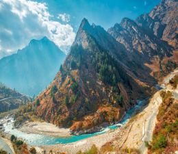
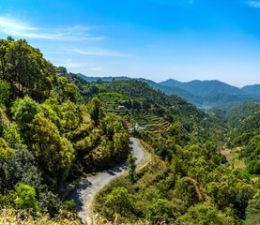
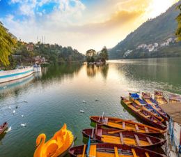
The Valley of Flowers is a beautiful and enchanting place in Uttarakhand's Chamoli district. It is an Indian national park known for its rich flora and fauna. It is 3352 to 3658 meters above sea level. Every year numerous hikers and travellers visit the Valley of Flowers. It is a popular hiking destination! The national park is 87.50 square kilometres in size, 2 kilometres wide and 8 kilometres long.

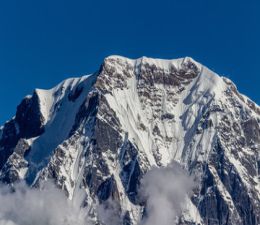
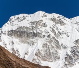
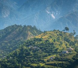
The Flower Valley has snow-capped peaks of the Himalayas as a backdrop. The Flower Valley excursion offers peaceful natural beauty. Joshimath is a sacred hamlet near Haridwar. It serves as the starting point for the enticing journey down the valley. 

The valley is believed to have been discovered in 1931. It was when three British climbers led by Frank S. Smythe got lost and chanced upon this spectacular valley. Attracted by the beauty of this place, they called it the Valley of Flowers.

Information about the blooming of flowers:

As the name suggests, the Valley of Flowers is a place where nature blooms. It offers a breathtaking experience. Exotic flowers (more than 600 species) such as orchids, poppies, primroses, marigolds, daisies and anemones are eye-catching. Subalpine birch and rhododendron forests cover part of the parking area. A hike into the gorge offers eye-catching sights such as cascading waterfalls and wild streams.

About the flowers

  • Vajardanti (Potentilla Atrisanguinea)
  • Pannir Soppu (Geranium Collinum)
  • Jalkutre (Primula Denticulata)
  • Balma-Jhar, Ban Ajwain (Thymus Linearis)
  • Himalayan Venus (Cypripedium Himalaicum)
  • Epilobium Latifolium
  • Operating hours of Valley of Flowers National Park

Vajardanti (Potentilla Atrisanguinea):

The word atrisanguinea is made up of two words: Atri means very dark and sanguinea means blood red. The flower looks very beautiful when you see it live in the Valley of Flowers. You want to touch it, eat it or keep watching it, especially for its colour and velvety texture. It blooms from June to August. You can also find some flowers near the Pushpawati river bed until mid-September.

Pannir Soppu (Geranium Collinum):

It blooms from July to August. You can find some lonely flowering plants near the Pushpawati river bed even in September. It is not as lush as its other counterpart, Geranium wallichianum. The word Collinum refers to hills - the habitat of the plant.

Jalkutre (Primula Denticulata):

It blooms from May to June. Around the beginning of June, it can be seen near the entrance of Hana no Tani. After about 150m you will see a frozen river. The colonies of Primula denticulata are easy to spot on its shores. 

The word primula comes from primus, meaning first. It refers to the first flowers to open in spring. It is used to treat diabetes and urinary tract disease.

Balma-Jhar, Ban Ajwain (Thymus Linearis):

It flowers from May to September. You will find Thymus Lineris among stones on your way to the Valley of Flowers. It is a mat-forming herb. It is heavily scented. It is responsible for beautiful pink spots in the Valley of Flowers. The whole plant is used to treat eye diseases, skin diseases, and stomach aches.

Himalayan Venus (Cypripedium Himalaicum):

This is a rare flower. It is found in Flower Valley. Although the flowering period is June to August, it is difficult to find them in the Valley of Flowers from the first to the third week of July. This is extremely rare. You need a guide who is knowledgeable about its location.

Epilobium Latifolium:

It flowers from July to October. You can easily see this flower on the banks of flowing water streams. The deeper you go into the Valley of Flowers, the greater the chances of getting its large colonies. It gives the Pushpawati riverbed its pink hue in July. These are some of the most seen flowers found in Valley in flowers. There are also many more flowers which you can spot and experience their beauty and fragrance.

Operating hours of Valley of Flowers National Park:

It operates Monday through Sunday from 8 a.m. to 5 p.m. You should head back around 1 p.m. to be back by 5 p.m. Although the valley is beautiful in May, June and September. But for the maximum number of flowers, July and August are the preferred months.

Activities to do in Valley of Flowers

  • The Valley of Flowers Trek
  • Hemkund Sahib
  • Govindghat
  • Mana
  • Joshimath

The Valley of Flowers Trek:

The Valley of Flowers trek is one of the most famous treks in the Himalayas. There is a reason the Valley of Flowers is legendary. This is one of the oldest known treks in India. The Valley of Flowers is on the list of places hikers around the world want to visit. However, the hike is not as simple as it looks. It is a moderate trek with slightly longer trekking days. It has a steep climb to Hemkund Sahib. This requires endurance.
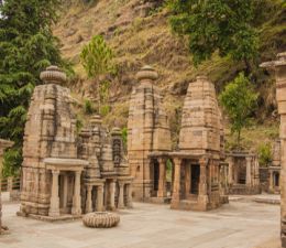
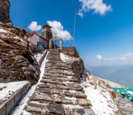
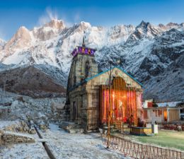
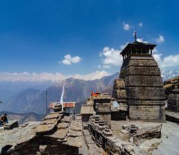
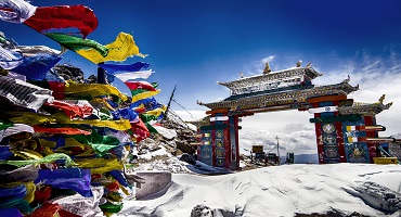
Hemkund Sahib:

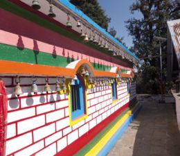
Hemkund Sahib is a Gurudwara at an altitude of 4329 m. It is located in the Chamoli district of Uttarakhand near the Valley of Flowers. This sacred shrine is named after the glacial lake Hemkund. Hemkund borders Gurudwara. It means a lake of snow. 

This Sikh pilgrimage site is dedicated to the 10th Sikh Guru, Sri Guru Govind Singh Ji (1666-1708). It is also mentioned in Dasam Granth. Dasam Granth is a work dedicated to Guruji himself. A small temple of Lakshman, the brother of Lord Rama, also adorns the shores of Lake Hemkund.
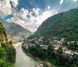
Govindghat:

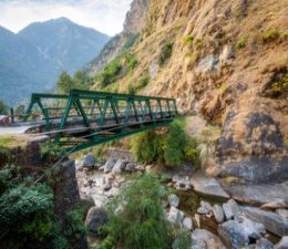
Govindghat is the place where the journey to Hemkund Sahib begins. Mules and porters can be hired on-site. It also serves as a tourist parking lot. It is located between the Alaknanda and Lakshman Ganga rivers. It is about 22 km from Joshimath.

Mana:

Mana is a must-see when visiting the valley of flowers. It is located on the border with Tibet. It is one of India’s most beautiful villages. This village is inhabited by the Indo-Mongolian tribe. They are known as the Bhotia.
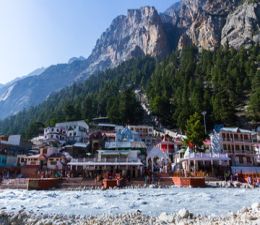
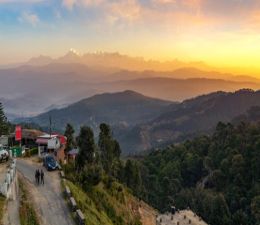
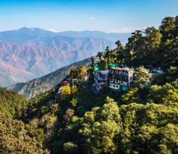
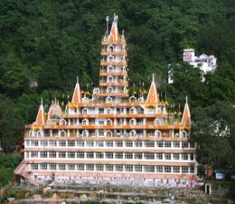
Joshimath:

Joshimath is one of the four Peethas founded by the great Adi Shankaracharya. This temple is situated at an altitude of 6150 feet in Uttarakhand. Joshimath is one of the sacred temples for Hindus. It is also the residence of Lord Badrinarayan.

Highlights of Valley of Flowers

Witnessing a valley covered in enormous varieties of flowers in all colours and tints of colour.

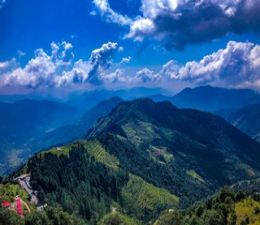
At 3,600m above sea level, the Valley of Flowers is a lively, colourful paradise where a wide variety of flowers thrive. The valley is surrounded by majestic snow-capped mountains, exquisite glaciers, waterfalls, streams, and fluffy clouds in the sky.

The Valley of Flowers National Park offers an amazing experience with the magnificent Himalayan peaks serving as the backdrop. The Valley of Flowers National Park is one of the two core zones of the Nanda Devi Biosphere Reserve. It is spread across an area of 87 sq. km in the Chamoli district. It is a UNESCO World Heritage Site. The second core zone is the Nanda Devi Valley of flowers National Park.

Three British mountaineers, commanded by Frank S. Smythe, are thought to have found the valley in 1931. They got lost in the forest and came upon this breathtaking valley. They gave it the name "Valley of Flowers". 

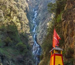
A 17-kilometre hike leads to the Valley of Flowers from the village of Govindghat. The uphill journey from Govindghat to Ghangharia is surrounded by breathtaking waterfalls, forests, and the Himalayas. Ghangharia is about 14 km away from Govindghat.

A permit must be obtained from the forest department to enter Valley of Flowers Uttarakhand. There are no lodging options inside the valley. So, visitors are only permitted during the daytime during the three-day permit's validity period.

The pilgrims frequently use the trek path to get to the Sikh temple in Hemkund.

The Sri Hemkund Sahib Gurudwara is a revered Sikh shrine. It is only open for a few months. It is closed during winter due to severe snowfall. Hemkund Lake reflects the majestic mountains and entrancing glaciers.

A lovely location to visit is the Nanda Devi Park adjacent to the Valley of Flowers. Rare vegetation and a variety of endangered creatures can be found in this stunning sanctuary.

Entry fees to the Valley of Flowers

Destinations: Govindghat to Valley of Flowers

Distance /Altitude: Approx. 20 km trek/ 4,389 m for family and groups

Budget: INR 12,000 per person (excluding airfares)

It is not unusual for the valley to be temporarily closed for a day due to safety precautions.

Everyone who travels must complete the Hemkund Sahib Registration Form on the E-Portal. 

Print the PDF after saving it. 

Carry a photocopy of your photo ID card, and your COVID immunization certificate(s).

From Govindghat to Pulna, a distance of 4 km, the track can be driven on the way to Ghangaria. This shortened the distance from a few years ago to about 8 Km. It takes 20 kilometres to get from Pulna to Ghangaria. From Ghangaria, it is an 8-kilometre hike to the Valley of Flowers. It is a 12-kilometre trek back from Hemkund. A total of 40 km or so must be traversed inside the valley on paved paths and trails.

It is still quite an easy trek to Bhuydar village. And then it would be an hour of steep climbing from Bhyundar Bridge.

Horses are a quick way to get back if there is an emergency. A helipad at Ghangaria also offers flights to and from basecamp Govindghat. 

Please take note that the helicopter will not fly when the weather is bad.

What you should carry:

  • A raincoat, poncho, or other waterproof jacket is a must-have.
  • Layer thermals, jackets, sweaters, hoodies, and whatever else will help you to stay warm.
  • A backpack to store your belongings.
  • A good pair of sports shoes with rubber soles so you have some traction on the route.

Weather in the Valley of Flowers

The best time to visit the Valley of Flowers is between July and August. The flowers are in full bloom during this time. The valley is open from June to October.

In the region of the national park, the seasonal bloom starts as early as June. Some flowers continue to bloom far into September. So, the time when you can see some blossoms lasts for around 16 weeks.

During the monsoon, the valley is covered in pink, white, blue, and violet hues (July-August). The valley is home to several common species, including Anemone, Bell Flower, Brahma Kamal, Blue Poppy, and Forget-Me-Not.

As the monsoon arrives fully, you will see a greater variety of species and flowers. The monsoon season begins in early July and lasts until the end of August. In this sense, any time in July or August is an excellent opportunity to visit the Valley of Flowers.

Interesting facts about the Valley of Flowers

  • The Valley of Flowers is a part of the UNESCO World Network of Biosphere Reserves. It is a World Heritage Site.
  • The Valley of Flowers - Myth and Reality and Ecology and Conservation of the Valley of Flowers National Park, Garhwal Himalaya are two publications on the valley. These were written by Professor Chandra Prakash Kala, a botanist at the Wildlife Institute of India.
  • It is thought that Lord Hanuman took Sanjivani from the Valley of Flowers to Lord Lakshman to heal him of his illness.
  • While returning from their excursion to Mount Kamet, three British mountaineers unintentionally came across it. They gave it the name.
  • Botanist Joan Margaret Legge of the Royal Botanic Gardens lost her life in the valley in 1939 while collecting flowers on shaky slopes. At the location, her sister built a monument in her honour.
  • It is home to unique alpine indigenous flowers, plants, and animals.
  • Bhyundar Valley was the original name of the Valley of Flowers.
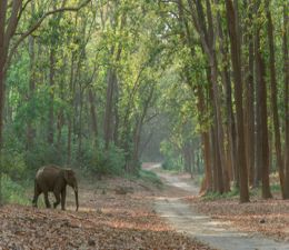
Flora & Fauna

Valley of Flowers National Park is nestled atop the tall Himalayan hills in the Chamoli region of Garhwal. It is always notable for its floral variety and unrivalled natural beauty. More than 500 kinds of vascular plants, 160 or more bird species, as well as various insects and mammals, call this biome home.

Nanda Devi National Park and Valley of Flowers National Park. are the West Himalayan landscapes with high altitudes.

This valley is home to more than 520 kinds of plants and flowers (recorded and identified), many of which are peculiar to this region.

Himalayan Rose (Rosa Macrophylla); Himalayan Honeysuckle (Leycesteria Formosa); Woolly Pearly Everlasting (Anaphalis Triplinervis) 14) Whorled Solomon’s Seal (Polygonatum verticillatum) 15) Devendra’s Balsam (Impatiens Devendrae) 16) Large Bellflower (Campanula Latifolia) 20) Himalayan Milk Vetch (Astragalus Himalayanus) 21) Himalayan Monkshood (Aconitum Ferox) 22) Purple Stalked Gentian (Gentiana Pedicellata) 23) Himalayan Thimbleweed (Anemone Obtusiloba).

Along with Nanda Devi National Park, this National Park makes the Himalayan regions full of the richest biological diversity. The blue sheep, brown bear, Asiatic black bear, civet cat, snow leopard, serow, and other mammals call this region home.

Monal, Snowcock, Vultures, Eagles, Laughing- thrushes, Pheasant, Warblers, Yuhina, Nuthatch, Partridge Honeyguide, Woodpeckers, Flycatchers, Magpies, Robins and Redstarts, Sunbirds, Accentors, Rosefinches, etc. are among the several species of birds. Numerous species of vibrant bees, moths, and butterflies can be seen.

Mythology related to the Valley of Flowers

To heal Lord Lakshman, it is thought that Lord Hanuman brought Sanjivani from The Valley of Flowers. This is Lord Indra's Nandan Kanan, according to Hindu mythology. The river Pushpawati's glacial action formed a high-altitude valley. It runs east to west beside the river. A legend states that the Pandavas gave the river the name Pushpawati. They did this after noticing flowers floating in its snow-fed waters.

When three British mountaineers Frank Smythe, Eric Shipton, and Romilly Holdsworth got lost in the forest and arrived at this valley instead of Mana village as they had originally intended. Thus, the valley's existence was known to the outside world.

How to reach the Valley of Flowers

Valley of Flowers is situated about 17 km from Govindghat. All you have to do is get to Govindghat and then navigate your way from there. From Govindghat, you can start a trek to Ghangaria. It is 13 km away. You have the option to hire a pony, a porter, or a helicopter, according to your liking and budget. However, a pony or a porter is more convenient. This is because helicopters may not be operational most of the time owing to poor weather conditions. After reaching Ghangaria, a 3-kilometre trek awaits you to the Valley of Flowers.

How to get to the Valley of Flowers by road

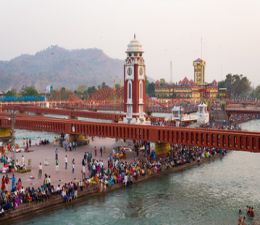
To get to the Valley of Flowers, first, you have to reach Govindghat. Govindghat is reachable smoothly via well-maintained roads. You can take a bus or hire a cab or taxi from Delhi or Haldwani.

To reach Govindghat from Delhi you have to take the following route:

  • Delhi
  • Haridwar
  • Rishikesh
  • Rudraprayag
  • Joshimath
  • Govindghat

To reach Govindghat from Haldwani Ranikhet, follow this route:

  • Haldwani
  • Ranikhet
  • Karnaprayag
  • Joshimath
  • Govindghat

Once you reach Govindghat from either of the above routes, you can begin a trek or hire a pony, porter, or a helicopter to Ghangaria and trek for 3 kilometres to reach the Valley of Flowers.

Getting to the Valley of Flowers by Train

The nearest railway station to the Valley of Flowers is Rishikesh. From there, you can take a bus or cab to Govindghat. You can plan the onward trip to the Valley of Flowers.

Reaching Valley of Flowers by Helicopter

Although getting a flight route from Delhi is easier, the nearest airport to the Valley of Flowers is Jolly Grant Airport in Dehradun. From there, you can take a bus or cab to Govindghat and choose the onward route. However, the distance from the airport to Govindghat is 292 km. So, this route might not be highly recommended.

Places to eat in the Valley of Flowers

The first thing to keep in mind before starting your trip to the Valley of Flowers from Ghangaria is that you will not get any food stalls, shacks, or restaurants here. The area is comparatively isolated from other nearby areas like Hemkund Sahib and Ghangaria. So, it is advisable to carry your food and water.

The smartest thing to do would be to get your food and water packed from one of the dhabas in Ghangaria. The food will cost you approximately Rs. 200. You can also choose to pack some snacks like energy bars, chocolates and such. 

However, do keep in mind to properly discard your waste rather than litter the beautiful Valley of Flowers.

Things You Should Know About the Trek to the Valley of Flowers

Visiting the Valley of Flowers when the flowers are in full bloom will make the visit worthwhile. May, June and September are beautiful times. But the best time to visit is July and August.

It is best to ask about the current weather conditions before planning your travel. This will help you to avoid any mishaps. In the monsoons, the weather conditions get worse so it is best to be informed.

What to carry with you for the trek

Before you plan a trek to the Valley of Flowers, make sure you are properly packed and prepared. Here is a list of things that you should definitely pack before you start your trek:

  • Lightweight jacket or windcheater of good quality to combat the cold
  • A couple of t-shirts, preferably one half and one full
  • Thermal clothing
  • Two lightweight trousers or tights. These should be comfortable for trekking
  • One pair of shorts
  • Trekking boots with good quality floaters for the trek, along with waterproof shoes
  • Two lightweight woollen or fleece jumpers
  • Lightweight, foldable umbrella
  • A woollen scarf, beanie or hat
  • A small torch with extra batteries
  • Water bottle, hand towel and basic toiletries
  • Sun shades or glasses
  • A camera, a notebook and a pen for your luggage
  • Small backpack for water bottles, food, and other items.
  • Basic medicines like bandages, antibiotics, and medicines for headaches, fever, vomiting and cold
  • Dry fruits like almonds, cashew, etc.
  • Energy bars

Places to stay in the Valley of Flowers

It is not allowed to stay overnight in the Valley of Flowers. But you can find various lodging options at Govindghat or Ghangaria.

  • Hotel Yoga: 12km from the Valley of Flowers
  • Amritara the Avadh: 12 km from the Valley of Flowers National Park
  • Bhajan Ashram Badrinath: 12 km from the Valley of Flowers National Park
  • Hotel Himgiri: 12 km from the Valley of Flowers National Park
  • Hotel Vasudeva Inn: 13 km from the Valley of Flowers National Park
  • The Tattva Resort: 21 km from the Valley of Flowers National Park
  • Mount View Annexy: 21 km from the Valley of Flowers National Park
  • The Sleeping Beauty Hotel by the Vedix Yatra: 21 km from the Valley of Flowers National Park
  • Cliff Top Club: 21 km from the Valley of Flowers National Park
  • Himalayan High, Auli, by Himalayan Eco Lodges: 22 km from the Valley of Flowers National Park
  • Auli Resort: 23 km from the Valley of Flowers National Park
  • Casa Himalaya: 23 km from the Valley of Flowers National Park
  • Mountain Rover Auli: 23 km from the Valley of Flowers National Park
  • The Snow City: 23 km from the Valley of Flowers National Park

Reasons why you should visit the Valley of Flowers

There are various reasons why you must visit the Valley of Flowers at least once in your lifetime. Some of them are listed below:

  • World Heritage Site: It has been designated as a World Heritage Site by UNESCO in 2005. It is a part of Nanda Devi National Park. It stretches over a land of 80.75 km. The Valley of Flowers is a 15-kilometre-long trek. Pilgrims and visitors prefer to visit here to spend some quiet, meditative time.
  • Unique Flora: When you visit the Valley of Flowers, you will be able to see some flora. These have been marked as endangered species according to the UNESCO website. Here you will find a larger number of medicinal plants as compared to the Himalayan region.
  • Most Searched for Place: The Valley of Flowers comes out in the maximum of searches for a tourist attraction in Uttarakhand when it comes to a place for meditative purposes.
  • Rare and endangered birds and animals: Visit the Valley of Flowers and you will get to see rare species of birds and animals like The Himalayan Monal, Himalayan Black Bears, Musk Deer, Red Fox, Blue Sheep, Snow leopard, and more.
  • Untouched yet well-manicured: The flora in the Valley of Flowers is left untouched but they look perfectly in shape and well-manicured just like a properly maintained garden. Of course, there are strict rules to not touch the outgrowth when visitors visit this area.
  • A delight for trekkers during monsoons: Not every trek is open during monsoons. However, the Valley of Flowers is an exception. It is one of the few places which is a major tourist attraction, especially during the monsoons. It is because the rarest and most beautiful flowers bloom here around this time. Another added factor is the ultimate beauty and sublime greenery of the region.
  • Hemkund Sahib: Hemkund Sahib is known to be one of the most resplendent and beautiful Gurudwaras in the world. As Guru Nanak Dev Ji said, “Tell your troubles to the one who is the source of all comfort”. Plan a trip to the Valley of Flowers and visit Hemkund Sahib. 

Here you will be able to taste the best Gurudwara Langar and deliciously soul-filling Guru Prasad. Rest here for a bit to give your aching and sore muscles some respite from the long trek. Take a dip in the holy water to rejuvenate your mind and body.

  • A heaven for photographers: If you love photography, Valley of Flowers is going to be an absolute treat for you! Get your Go Pros and DSLRs to check some of the best shots here. The beauty, greenery and grace of the land are incomparable. Just like out of a fairy tale, capture the beauty of this place with your camera. Take it back to cherish at home.
  • Inhale pure oxygen: Looking for a place where you can get away from the hustle, bustle and pollution of the busy city? Take a trek up to the Valley of Flowers and take in the purest of oxygen.
  • Tourism income for villagers: This place is a source of income for the Pulna and Bhyundar villages. So if you visit the Valley of Flowers, you are actually promoting their livelihood.

All in all, the Valley of Flowers is one of the most isolated and green tourist attractions. Here, you can find peace, tranquillity and pure oxygen to rejuvenate your mind, body and soul. Visit here and see if you are lucky enough to see the Brahma Kamal flower. This Brahma Kamal flower is quite a rare find in itself.

Read More

Kedar Tal Trek

Fill Your Senses with Adventure, Thrill, and True Divinity of Nature!

Information about the Kedar Tal Trek

Kedar Tal trek flourishes amid lush green meadows, snow-covered Himalayan peaks, bubbling springs, and enriching flora and fauna. The place also holds religious importance as the lake is believed to have been born from the blessings of Lord Shiva. 

The beauty of Kedar Tal is boundless, but the trek can be a bit challenging albeit magical for beginners. The 18 km trail is ample with spider walls, rocky terrains, steep slopes, and large boulders, and thus, requires the trekkers to be physically and mentally strong! 

However, the first touch of the translucent water of Kedar Tal is healing enough to soothe the five senses of the tired trekkers. The silence surrounding the lake is so loud that it soothes one’s mind, body, and soul.

Kedar Tal, is, thus, a paradise for meditators, poets, photographers, yoga practitioners, and artists, but also a boon for those who wish to break free from the mundaneness of regular life. 

Location

Settled at an elevation of almost 16,000 feet, Kedar Tal Trek starts from the temple town of Gangotri, in Uttarkashi district, Uttarakhand. 

The local language of Kedar Tal

The locals of Kedar Tal usually converse in Garhwali, one of the dialects of Hindi, which is also widely spoken in the region. Many natives also understand English, so trekkers can easily roam around the region. 

What is Kedar Tal known for?

The trek to Kedar Tal can be a bit challenging for the novice but the experience is truly magical. 

Kedar Valley brims with all the fragrant things that grow in nature – gurgling rivers, vibrant meadows, rambling waterfalls, snow-covered Himalayan peaks – the list is endless.

Kedar Tal, also known as Lord Shiva’s Lake, offers picturesque views of Himalayan peaks, like Manda Parvat, Mt. Thalay Sagar, Mt. Bhrigupanth, Mt. Jogin, and Mt. Gangotri. 

The hidden gem of the Kedar Tal trek is the spotting of mountain goats, known as Bharal, or Blue Sheep, along with Himalayan Black Bear, and Gorals. So, if there is one word to define the beauty of this magnificent glacial lake, it is divine! 

How to reach Kedar Tal?

The base or starting point of Kedartal trekking is Gangotri, which can be reached easily from Dehradun, Rishikesh, and Haridwar via private taxi or Volvo.

The nearest airport to Gangotri is the Jolly Grant Airport, Dehradun, which takes about an hour to reach the ISBT, from where one can find a cab or bus. Kedar Tal trekkers who don’t mind splurging can also visit Sahastradhara Helipad, Dehradun, to travel to Gangotri via helicopter service. 

From Gangotri, the trekkers cover a distance of 18 km on foot to reach the lake of Kedar Tal in around 3-4 days. 

Cost to reach Kedar Tal?

The Kedartal trek cost depends on a lot of factors, like accommodation, food, and transport. A typical Kedartal trek itinerary would cost the trekkers around 15k to 20k. 

The private cabs charge around INR 7K to INR 15K while Volvos cost between INR 700 and INR 1000 to Gangotri. The trekkers can go through a good Kedar Tal trek guide to learn more about a typical Kedartal trek package. 

Interesting facts about the Kedar Tal 

The starting point of the Kedar Tal trek, Gangotri, is one of the Char Dhams in Uttarakhand. 

Kedar Tal translates as Shiva’s Lake since ‘Kedar’ is one of the Lord’s names. 

Kedar Tal is one of the highest lakes in Uttarakhand, and also the most remote one. 

Activities to do in Kedar Tal 

  • Camping: Put up a tent in Kedar valley, set up a bonfire, and revel under the glory of a moonlit, starry sky. Kedar Tal is certainly one of the most gorgeous places for camping. 
  • Sightseeing: The entire district of Uttarkashi brims with temples, streams, natural springs, and breathtaking views of the Himalayas. One can stroll through the vibrant town of Gangotri, spend a night in Harsil, or explore the untouched corners of the valley. 
  • Photography: The majestic peak of Mt. Thalay Sagar serves as the perfect background for the azure waters of Kedar Tal, and thus, makes for a great montage for photographers. 

Highlights of Kedar Tal 

  • Setting up a camp near the pristine water of Kedar Tal. 
  • The climb to and through the iconic yet infamous spider walls
  • Heavenly view of the Greater Himalayas, including Mt. Gangotri, Mt. Thalay Sagar, Mt. Mt. Bhrigupanth, etc.
  • The breathtaking vistas of Bhoj forests.
  • Visit Gangotri Temple, one of the pilgrim sites from the Char Dham in Uttarakhand. 

Weather in Kedar Tal

The best time to do the Kedartal trek is during May and June, September and October. A Kedartal trek in May means shimmering emerald-green mountains, colourful meadows, and gurgling streams that truly bring out the beauty of this scenic place. 

Mythology related to Kedar Tal 

As per the legend, Lord Shiva, created the Kedar Tal lake to contribute to River Bhagirathi by letting Kedar Ganga become its tributary. 

The crystal-clear water of Kedar Tal is thus fed by the River Kedar Ganga, which is believed to have plunged from the locks of Lord Shiva to purify the ashes of King Bhagirath’s ancestors with her pure yet commanding flow. 

Kedar Tal History

Kedar Tal was formed by the melting of the Kedar glacier and is the birthplace of Kedar Ganga, a tributary to the Bhagirathi River. Since the lake is fed by Kedar Ganga, it came to be known as Keda Tal and is highly revered by the locals. 

Where/What to eat in Kedar Tal 

There is no shade or shelter once the trek starts from Gangotri. It is thus recommended to carry your food, or a cook, to the trek. The restaurants in Gangotri usually offer vegetarian food since it is a pilgrimage center. 

Where to stay in Kedar Tal? 

There are several hotels and homestays in Kedar Tal, Gangotri and nearby areas. Hotel GMVN Gangotri is usually a good lodge with decent rent to stay for trekkers. 

However, there is no shelter once the Kedar Tal trek starts, so trekkers carry their tents to stay the night in campsites, like Bhoj Kharak and Kedar Kharak. 

Why is Kedar Tal a must-visit?

The Kedartal Trek is an adventure of a lifetime for anyone who finds peace and seeks thrill amid the heavenly beauty of the mighty Himalayas. One will enjoy the enchanting meadows and meandering streams on one side of the trail while losing their breath as they climb up the spine-chilling spider walls, on the other. The end reward of all the effort put into this trek will be the indescribable beauty and divinity of the Kedar Tal lake that will beckon you to come close and seek the blessings of Lord Shiva who has energized this serene lake with His unceasing energy.

Read More

Chopta Tungnath Trek

Located in the Garhwali Himalayas, Chopta Tungnath is an easy-to-moderate weekend trekking trail with a maximum elevation of 13,000 ft above sea level.

The Chopta Tungnath trek, also known as the Chandrashila Summit trek, requires 3–6 days of daylight trekking through the mountains of Uttarakhand, India. The ideal time to do the trek comfortably is between April to November. Trekkers can see a myriad of picturesque vistas, including the bloom of rhododendron forests, if they visit between February and July. In winter, it can get risky to trek certain parts of the trail due to landslides and avalanches.

Trekkers will have to begin their journey from Haridwar and drive to Ukhimath before starting their hiking journey to the destined elevation, surpassing the misty coniferous forest.

Location of Chopta Tungnath Trek

Chopta is a small village in the Kedarnath Wildlife Sanctuary in the Rudraprayag district of Uttarakhand. It is 400 km (249 miles) from the national capital Delhi and easy to reach by road. The only route reaching Tungnath in the Chopta Tungnath trek is the uphill hike from Chopta.

Highlights of ‘Chopta Tungnath'

The captivating beauty of the red, scarlet, and pink rhododendron forest on the trail from Chopta to Tungnath, followed by dense coniferous trees like oak, maple, and pine forests.

Hike to the oldest Shiva Temple in the world, at 12,000 ft elevation, amidst snow-capped mountains.

Breathtaking views of Nanda Devi, Kedarnath, Bandarpuch, Chaukhamba, and Trishul while trekking from Chopta to Tungnath, which get even better at the summit.

Beginning at the Sari village, the trail offers a close view of the rural Himalayan civilisation, especially the ancient Garhwali culture among the locals.

Experience the stunning beauty of the Deorital Lake at a 3 km elevation from Sari village en route to the Ukhimath-Chopta road.

Walking through Kedarnath Wildlife Sanctuary, hikers can witness flocks of migratory birds throughout their Chopta-Tungnath-Chandrashila trek journey.

Chopta Tungnath Trek Guide

The most exciting adventure on this trek starts on day 3 in the early morning hours, ideally an hour before sunrise. The concrete road from Chopta to Tungnath is safe for travel at this hour. A steep climb and a few road bends will take the hikers to a sharp turn and further to the location of temples and religious flagpoles.

The Chopta Tungnath trek starts from Haridwar, which is well-connected by roads from Delhi. Hikers willing to experience the Chopta Tungnath Chandrashila trek must travel to the capital city of India either by flight or by air.

Places to visit in Chopta & Tungnath

The Chopta-Tungnath trail is as entertaining to nature lovers as it is to adventure enthusiasts and veteran trekkers! From the start to overnight camping at the Chopta Tungnath summit, it is a traveller's paradise.

One will pass several outstanding locations during the Chopta-Tungnath trip.  

Tungnath Temple

Tungnath Temple is the oldest Shiva temple in the world, established 1000 years ago by the local Garhwali people. The temple is 4 km uphill from Chopta and easy to reach by car and on foot. The Tungnath Temple is highly revered as one of Uttarakhand's five Panch Kedar Temples dedicated to Lord Shiva.

Chandrashila Trek

Located at 12,110 ft, this summit is a viewpoint for all major Garhwali peaks and is religiously significant. It is believed that Lord Rama meditated here after defeating Ravana in Lanka. Legend also says Lord Chandra spent his penance here, from which the peak gets its name. 'Chandrashila' literally translates to a moon rock.

Sari Village

The first campsite of the Chopta Tungnath trek route, Sari village, nestles in the lap of rhododendron forests on the slopes of the Garhwal Himalayas. The top attractions here are the beautiful snow-scattered Deoria Tal Lake and a glimpse of the local culture. 

Omkar Ratneshwar Mahadev

The Omkar Ratnashwar Mahadev Temple is dedicated to Naga Devta or Nagraj, the snake Lord Shiva carries around his neck. The temple is located on the return route from Deoria Tal Lake to Sari Village. 'Nag Panchami' is a massive festival at the temple, but avoid visiting at the time if you dislike crowds.

Kalimath

Located at 6,000 ft on the banks of the Saraswati River, Kalimath is one of the 108 Siddha Peethas of Goddess Kali. This spot is believed to be where Kali killed the demon Raktavija. This is the only temple where Kali is worshipped with Lakshmi and Saraswati. However, no idol is worshipped here. Instead, the Sri Yantra is the object of devotion. It is located 50 km away from Chopta towards Sari.

Dugalbitta

Located 7 km before Chopta, Dugalbitta is a scenic spot in the Kedarnath Wildlife Sanctuary. It is a vibrant spot for photography and also a lovely camping site. Birdwatching, hiking, and cycling are fun activities to do here.

Kanchula Kharak Musk Deer Sanctuary

A 7 km turn towards the Chopta-Gopeshwar road can land visitors in a serene location with rich flora and fauna. The Kanchula Kharak Musk Deer Sanctuary is an ideal location to spot Askot Musk Deer and other Himalayan wild birds and animals. 

Activities to do in the Chopta Tungnath trek

Chopta is sometimes referred to as the mini-Switzerland of India because of the lush greenery of spring, the burst of red rhododendrons during summer, the fiery orange of autumn, and carpets of fallen snow in winter. 

Here is a list of activities for anyone to enjoy the time they spend in Chopta. 

Camping at Chopta

Chopta's landscape comprises rolling meadows and Himalayan peaks on all sides, making it an ideal camping spot with memorable nighttime bonfires. The location is 8464 ft from the sea level, easy to travel by motor vehicles, and the Deoria Tal is within an hour of walking distance. Tourists find camping in Chopta a soul-charging activity, especially for the colourful rhododendron trees surrounding the entire place.

Snow Trekking Routes from Chopta

Chopta is the hub of almost all the important treks of the Uttarakhand region. The famous Valley of Flowers Trek, Kuari Pass Trek, and the Panch Kedar Trek pass through the Chopta region. Pilgrim visits of the Kedarnath, Rudranath – Kalpeshwar, Madmaheshwar and Kali Shila Trek surpass the Chopta region for the easy-to-access location.

Birdwatching in Chopta Valley

Chopta is famous as a birdwatching location alongside a popular trekking route. Nearly 240 species of birds can be spotted in Chopta, including the local Himalayan monal, Himalayan griffon, and some migratory birds like the scarlet finch. The slopes of Chopta Chandrashila Tungnath are ideal for tourists to witness the wildlife, especially on the way to Tungnath peak.

Mountain Rappelling

Mountain Rappelling is one of the trendy adventure sports around the Chopta region, where a person gets to climb down a rock with a rope tied around their torso. The point of the sport is to experience the adrenaline of descent along the mountainous slope but without the risks associated with doing it freehand. 

Perfect Weather for Chopta Tungnath Trek

April to June, followed by September to November, are the ideal periods to experience the Chopta Chandrashila Tungnath trek. During this time, you will get clear skies and pleasant weather.

Chopta Tungnath Temperature in Summer

During summer, the Tungnath trek from Chopta is pleasant, with the temperature reaching around 22 degrees Celsius during the day and a maximum of 2 degrees Celsius at night.

Chopta Tungnath Temperature in Winter

The Chopta and Chandrashila trek sees an average of 2 degrees Celsius temperature in winter mornings. It goes down to a maximum of -8 degrees Celsius at night. It is not an ideal time to visit. From late winter, the snow begins to thaw, making way for trekkers to visit again.

Chopta Tungnath Temperature in Monsoon

The average monsoon temperature is around 19 degrees to 4 degrees Celsius from morning to night for the entire trek from Chopta to Tungnath region. It is better to avoid monsoon season, as the terrain will be slippery and hard to travel on.

Interesting facts about the Chopta Tungnath Trek

  • The trek will take you to one of the five Panch Kedar Shiva temples in Uttarakhand that are highly revered and worshipped locally.
  • Despite an elevation of 12,000–13,000 ft, the trek is easy to moderate and can be done even by amateurs.
  • It can be covered in 2–4 days at most. 
  • It is a perfect trail to witness the famous Rhododendron blooms of the Garhwal and Kumaon Himalayas. 
  • The locations here are rich in mythical heritage pertaining to the Hindu faith. 
  • The summit offers scintillating views of nearby peaks.

History of the Tungnath Temple

The Chopta Tungnath trek features the 1000-year-old Shiva Temple at the summit, which has rich lore connected to it. Tungnath, meaning the Lord of the Peaks in Sanskrit, forms the river valleys of Mandakini and Alakananda. The Tungnath Temple is one of the five holy sites that form Panch Kedar. Local legends state that when the Pandavas came looking for Lord Shiva in the mountains of Garhwal, he disappeared and later reappeared in five different parts to avoid the brothers as he was incensed about the bloodbath of Kurukshetra. Tungnath was one of the places Lord Shiva's arms surfaced here after his disappearance.

The Chandrashila peak, located a little above Tungnath, is believed to be the spot where Lord Rama penanced for the brutalities of his war with Ravana. He prayed to Shiva to wash away the sins he committed by murdering Ravana and his army. 

Where to eat during the 'Chopta Tungnath' Trek?

Aloo parathas with special Himalayan pickles are a commonly savoured dish at Chopta Tungnath trip homestays. Many roadside shacks serve authentic North Indian delicacies in and around Sari. Expect the cuisine to be mostly vegetarian. 

Path of the Chopta Tungnath Trek

  • Day 1: Sari to Deoria Tal
  • Day 2: Deoria Tal to Chopta
  • Day 3: Chopta-Tungnath-Chandrashila Trek

Day 1: Sari to Deoria Tal

Before the trek commences, you will reach Haridwar from Delhi Haridwar via the NH 334 highway running along the Bhagirathi and Alakananda Rivers. The time taken is approximately 5 or 6 hours for the 242.6 km distance. The train route requires approx 7 hours to reach Haridwar railway station.

The trek towards Chopta begins the next day. Start early to cover a considerable distance by nightfall. The trail initially passes through the Kedarnath Wildlife Sanctuary with a mix of upward and downhill elevation till Tungnath. The altitude here is around 9,600 ft. Certain stops will give a clear view of the Chandrashila summit. 

After crossing a ridgeback of a mountain, trekkers will reach a resting point in Sari village. It is built and controlled by the Uttarakhand Forest Department of India. The trail becomes slightly difficult with a constant uphill elevation.

Depending on the walking speed, you can spend 20 minutes at the resting spot. The breathtaking views and fresh mountain breeze will refresh and energize everyone for further climbing. 

After a hike for an hour or two, you can see Deoria Tal, where you will camp for the night.

Day 2: Deoria Tal to Chopta

The next day, the trail familiarises hikers with the Himalayan atmosphere with a view of Kedarnath's summit at a distance. The initial route will be lined with the iconic colourful flags of the Buddhist faith along the ascent via Rohini Bugyal. Here you will also spot many rhododendron plants.

You can expect to spot some wildlife in the oak forests, such as bison, deer, and red-tailed fox. The overall uphill trek for 7-8 hours will lead to the Chopta campsite, accompanied by a breathtaking sunset.

Day 3: Chopta-Tungnath-Chandrashila Trek

The most exciting adventure on this trek starts on day 3 in the early hours of the morning, ideally an hour before sunrise. The concrete road from Chopta to Tungnath is safe for travel at this hour. A steep climb and a few road bends will take the hikers to a sharp turn and further to the location of temples and religious flagpoles.

On the 10th turn, hikers can get a stunning view of the Chandrashila summit, followed by the next bend taking them directly to the Tungnath top.

Tungnath gives a superb 360-degree view of the Kumaon and Garhwali Himalayas on all flanks. The snow-covered crowns of Dronagiri, Trishul, Nanda Devi, Kedarnath, and Chaukhambi peaks can be spotted at a distance. A slight glimpse of the Gangotri and Thalaysagar range is also possible if the sky is clear.  

You will retrace your steps and return to Chopta the same day.

Where to stay during the Chopta Tungnath Trek?

Chopta has a lot of wonderful places for tourists, like the Tattva, Birdsong & Beyond, The Meadows Resort & Camp, and the very famous Blue Poppy Resort for the luxury living experience. Homestays like the Himalayan Homestays, Neelkanth homestay, or the Stop-off Café & stays provide tourists with a local lifestyle experience! 

Travel tips for the Chopta Tungnath Trek

  • Being fit is extremely important for trekking to 9000 ft. Do not go if you have tendencies of vertigo, nausea, heart conditions, musculoskeletal issues, asthma, or you are pregnant. 
  • Make sure to stay hydrated along the journey. 
  • Mules and porters are easily available in the Chopta Tungnath region to carry luggage. 
  • Do not compromise on gear, wear the right outfit and shoes, and follow the team leader at every step. Do not forget thick gloves to avoid frostbite. 
  • Make your hotel bookings in advance.

FAQs

  1. Is the Chopta Tungnath trek route difficult?

    The Chopta Tungnath trek is a climb of moderate difficulty. Anyone who is fit and has no physical ailments level can trek along the trails of Tungnath.

  2. What is the ideal time to visit Chopta Tungnath location?

    April to June and September to October is the ideal time to trek Chopta-Tungnath.

  3. What should I wear while trekking in Chopta & Tungnath?

    Warm, woollen clothes layered with wind-cheater jackets will be adequate to beat the cold. Make sure to carry a pair of thermals, a fleece jacket, woollen caps, and socks for a comfortable trip. Wearing trekking boots is a must.

  4. Is mobile reception available in the Chopta Tungnath region?

    Chopta to Tungnath and Chandrashila trail has no mobile connectivity. In the villages below Chopta, BSNL and Airtel provide connectivity.

  5. Which peak is visible from the Tungnath summit?

    Hikers can get a clear view of Chandrashila Peak, located at an elevation of 3,690 m from the Tungnath summit. Bandarpunch, Trishul, Kedar, Nandadevi and the Chaukhambi are also visible from Tunganath.

  6. Why go on a Chopta Tungnath Trek?

    The Chopta-Tungnath-Chandrashila trek is one of the wonderful trek routes in Uttarakhand, India, where a person can witness Himalayan wildlife and thick coniferous forests while walking on rocky terrain at the height of 9,600 ft above sea level. The route is special because one can witness the tranquillity of the Bugyals and the snow-capped Himalayan peaks by only walking 5–6 km at the height of 12,000 ft.

Read More

Bali Pass Trek

Bali Pass Trek

An Offbeat Path to Explore the Himalayas and Expand Your Trekking Abilities!

Bali Pass is a mystical place settled in the lap of the mighty Himalayas and extends an invitation to anyone who seeks a thrill away from bustling city life. 

Information about the Bali Pass Trek

From silvering snow fields to uninhabited villages, Bali Pass has several attractions hidden in layers. You can take a dip in holy waters, seek divine blessings, find photo opportunities at every step, and camp under a starry night sky—all within a week!

Location

Bali Pass sits at an elevation of 16240 ft and is nestled in the Govind Ballabh Pant Wildlife Sanctuary in the Uttarkashi district of Garhwal, Uttarakhand.

Trek Guide 

  • Be well-informed about the trek. Read about the experience of other trekkers who have already been there. Read Bali Pass trek blogs to learn more about the same. 
  • Carry mandatory legal documents such as ID proof, medical certificate, passport-sized photograph, etc. 
  • Pack a personal medical kit in your backpack. Make sure to add paracetamol, Avomine, Digene, Dolo 65, etc. 

Places to visit in Bali Pass 

Yamunotri Temple 

Yamunotri Temple is one of India's four Chota Char Dham pilgrimage sites dedicated to Goddess Yamuna. You shouldn't miss taking a dip in the resplendent springs of Gouri and Surya Kund.

Gangad and Osla Villages 

Brimming with old temples, interesting Himalayan folklore, and lush green meadows, these ancient villages will take you back in time and are covered under the Bali Pass trek cost.

Ruinsara Lake 

It is a serene glacial lake that boasts tranquillity in every sense and is still untouched by commercialisation. So, you can soak in some peaceful vibes while gazing at the panoramic views.

Activities to do in Bali Pass 

Stargazing 

If you are a fan of stargazing, make sure to carry your own telescope to witness the stars and galaxies from Bali Pass.

Camping 

Bali Pass is a hot spot for campsites like Dev Thatch, Untigad, and Damini Forest. Just put up your tents, light a bonfire, and dance through the night!

Village Tour 

Bali Pass is surrounded by many ancient villages that still hold the Himalayan culture close to their souls. Trekkers love to soak in the majestic views of the Himalayas from these unexplored hamlets. 

Bali Pass trek is a delight for anyone intrigued about exploring the mysteries of the mighty Himalayas.

Highlights of Bali Pass

  • Witness clear views of the Bandarpoonch, Swararohini, and Kala Nag peaks. 
  • Camp under the stars in Dev Thatch and soak in the healing vibes of the alpine settings. 
  • Visit the Yamunotri temple amid nature's glory and the meandering Yamuna River. 
  • Walk along the Tons and Supin Rivers. 

Bali Pass Weather 

  • The Bali Pass trek best time to visit is between May and June. Bali Pass weather is quite pleasing at this time, with 12 to 17 degrees during the day and below zero degrees at night.
  • The Bali Pass trek route is also perfect to visit in September and October. Bali Pass temperature in autumn swings between 1o to 14 degrees during the day and zero to -3 degrees at night. 
  • As the Bali Pass temperature typically drops below 0 degrees, carrying padded jackets, woollen caps, mufflers, socks, thermals, gloves, and at least three T-shirts to the trek is recommended. 

Interesting facts about Bali Pass

  • It connects Har-ki-Dun with Yamunotri Valley offering some splendorous valley view full of alpine meadows and lush green hillsides. 
  • It also traverses the confluence between Tons and Ruinsara Rivers which meander along the trails most of the time. 
  • The Bali Pass trek route is home to more than 150 species of birds, including golden eagle, black vulture, and Himalayan monals. It is, thus, a paradise for bird watchers. 
  • Mythology related to Bali Pass
  • Many locals believe their ancestors traced their origins to the Pandavas of Mahabharata. A few also tell stories about their connection with the Kauravas mentioned in the epic. 
  • It is believed that only Yudhishthira, out of all Pandavas, was able to attain heaven from Swargarohini, the snow-covered Himalayan peak visible from this trek.

History of Bali Pass 

The history of the Bali Pass trek goes back to the time of Ramayana, when Bali, the ruler of Kishkindha Mountain, travelled to Uttarakhand to kill a demon named Odari. The trek was thus named after Bali, who killed the demon, and returned to his kingdom with glory.

How to reach Bali Pass 

Buses are available from Dehradun to reach Sankri. It takes about 10 hours for passengers to reach Sankri from Dehra. 

One can board a train from Delhi to reach Dehradun and board a bus from ISBT, which is within walking distance from the station. The nearest airport to Sankri is Jolly Grant Airport, Dehradun, and it takes about an hour to reach the bus station from there. 

A private cab to the Bali Pass trek costs around INR 3000-8000.  

Where/what to eat in Bali Pass

There are no restaurants or shops on the trek to Bali Pass, so it is advised to buy all supplies at Sankri. Tour guides and companies usually bring a cook to serve food.

Information about the Bali Pass Trek 

A typical Bali Pass trek itinerary would usually comprise an 8-day trip via Dehradun, Sankri, Taluka, Seema, Dev Thatch, Damini Forest, and Janki Chatti. Here's a breakup of the itinerary of the trek to Bali Pass. 

  • On day 1, trekkers reach Sankri village from Dehradun via cab or bus. 
  • On day 2, the Bali Pass distance from Sankri and Taluka shall be covered before resting at Seema. The route is full of dense forests, green meadows, and gurgling streams. 
  • On day 3, trekkers usually spend a good lot of time at the velvety Dev Thatch meadow indulging in activities like camping and photography before moving forward.
  • Day 4 is about losing oneself in the magnificence of snow-covered Himalayan peaks, listening to the chirping of exotic birds, and sitting by the silence of Ruinsara lake. 
  • By day 5, before the Bali Pass weather complicates the trek, advance towards the base camp at around 4 in the morning. Soak in the silver of the snow fields and put up a camp at the Damini Forest campsite. 
  • Day 6 is the time to relax and enjoy the trail to the pass. Some even visit the Yamunotri Dham to seek the deity's blessings before reaching Janki Chatti.
  • On day 7, trekkers drive to Barkot before bidding farewell to this challenging yet wonderful trek. The overall Bali Pass trek distance from Sankri is about 60 km, so one can plan accordingly.

Where to stay 

At such high elevations, one cannot expect to stay in a hotel or even a homestay. Most trekkers usually stay at the Meraki Homestay in Sankri or carry their own sleeping bags or tents. They also rest at the GMVN Guest House at Seema while on the way to the base camp. 

The resting abode of most trekkers heading towards Bali Pass. 

Travel tips 

  • There is no network coverage in this region. 
  • There is a fully-functional ATM at Pulora, but trekkers must carry cash.
  • There is no curfew for the entry and exit for trekkers to Sankri, but driving on spiral roads after dark can be dangerous. So, trekkers try to arrive before 5 PM.

FAQs

  1. What is the difficulty level of the Bali Pass trek?

    One must have gone to at least 5 treks before signing up for Bali Pass Trek. The difficulty level is somewhere close to 7 on a scale of 10.

  2. How many days are required to cover the Bali Pass trek thoroughly?

    It usually takes 7–8 days to complete the trek to Bali Pass. One may take more time if they are not a regular trekker.

  3. Is the Bali Pass trek safe for solo and women travellers?

    Bali Pass is completely safe for solo and women travellers, but taking the necessary precautions is still recommended before travelling.

  4. What is Bali Pass famous for?

    Bali Pass trek is famous for its high altitude, majestic Himalayan peaks, unexplored villages, camping sites, cultural exchange, and more.

  5. Can a 50-year-old go on a Bali Pass trek?

    Bali Pass is a high-altitude trek, so whether they can go on this trek depends on an individual's health.

  6. Why is Bali Pass a must-visit?

    Bali Pass is an authentic trekking destination for those who seek thrill and adventure and love tranquillity and peace. Its flora and fauna, alpine meadows, ancient temples, Jaunsari houses, rich culture, interesting folklore, majestic Himalayan views, etc., are some reasons why Bali Pass is a must-visit for all.

Read More

Pangarchulla peak Trek

Information about Pangarchulla peak

Pangarchulla peak is the trek of a lifetime for regular trekkers, mountain lovers, and thrill seekers. The magnificent views of some magical Himalayan peaks, including Nanda Devi, the second-highest peak in India, is a subtle experience bringing a sense of accomplishment to the trekkers. 

And let’s not forget the absolute divinity which surrounds the summit in the form of bubbling springs, thick pine forests, rugged slopes, blooming meadows, and snowy boulders. 

Location 

The summit of Pangarchulla Peak is perched at an elevation of 15,069 ft and starts from a beautiful town called Joshimath nestled in the Garhwal region of Uttarakhand. The trek takes the visitors through the Nanda Devi National Park.

The local language spoken in the Pangarchulla

The locals usually use Garhwali and Hindi to converse with each other. However, most of them understand English, so, language is the least of all concerns for the trekkers.

What is Pangarchulla peak known for? 

Pangarchulla peak is known for its high elevation which makes it possible for trekkers to have unrestricted views of majestic Himalayan peaks, including Nanda Devi, Hathi Ghoda, Neelkanth, and Kamet.

Besides, there are several gurgling streams, misty hillsides, unexplored hamlets, and colorful meadows that have the power to heal the senses of those who touch their boundaries. Trekkers can also go sightseeing in Joshimath, Auli, Vishnuprayag, and Ghangaria, to expand their travels.

How to reach Pangarchulla peak? 

The starting point of Pangarchulla is Joshimath, which is the gateway to some famous pilgrim sites, including Badrinath and Hemkund Sahib. Joshimath, is thus, easily accessible via road from Haridwar.

One can board a train or catch a flight to Haridwar from where they can either book a cab or hop on a bus to reach Joshimath. The closest airport to Haridwar is Jolly Grant in Dehradun, and it takes about two hours to reach Haridwar from the port.

From there, one can get a Volvo or hire a private cab to reach Joshimath. It takes about 8 to 10 hours to cover the distance from Haridwar to Joshimath. The Pangarchulla trek distance from Joshimath is around 38 km and is covered less by driving and more by foot.

Cost to reach Pangarchulla peak

The private cab costs between INR 8K to 12K to reach Joshimath from Haridwar or Rishikesh. The Volvo or AC- buses charge around INR 700 to 900 to cover the distance between the source and destination station. From Joshimath, the Pangarchulla peak can only be accessed via drive or foot. 

Interesting facts about the Pangarchulla peak 

  • The trek is famous for its summit club and takes about 6-7 days to finish. 
  • Khullara, Gulling top, and Tali Lake are some of the best camping sites on the Pangarchulla peak trek itinerary. 
  • One can spot Musk Deer and Himalayan bears on their way to Pangarchulla peak summit. 
  • Lies on the popular Lord Curzon trail and through the Nanda Devi National Park. 
  • Recommended Pangarchulla tour packages 
  • The Pangarchulla trek is one of the most challenging summit treks in the Greater Himalayas. So, one should trek the Himalayas Pangarchulla with a guide under a tour package. 
  • One can go through some popular Pangarchulla trek blogs to learn about the best Uttarakhand tour packages and book their Pangarchulla peak trip accordingly.  

Activities to do in Pangarchulla

  • Local Sightseeing: The starting point of Pangarchulla, Joshimath is a pilgrim town, and home to several ancient temples. Trekkers also prefer to visit Auli, known for skiing, Nanda Devi National Park, and Ghangaria – the list goes on!
  • Camping: One cannot just visit Pangarchulla and not set up their camps under a sky full of stars. There are several camping sites to set up one’s tents. 
  • Bird-Watching: The trails of Nanda Devi National Park and Panpatia Col are a paradise for bird-watchers. From flycatchers and barbets to whistling thrush and Himalayan griffon, trekkers can spot a variety of Uttarakhand birds. 

Highlights of Pangarchulla peak 

  • Macrocosmic views of Himalayan peaks, including the Nanda Devi, Neelkanth, Hathi Ghoda, Dhronagiri, Chawkhamba, Kamet, etc. 
  • Breathtaking alpine meadows and deodar forests, lush grasslands, oak trees, and gurgling streams throughout the trekking trail. 
  • A steep yet delightful ridge climb at an altitude of 15,069 ft. before reaching the summit. 

The weather at Pangarchulla peak 

The Pangarchulla weather is usually cold throughout the year when compared to the Himalayan foothills. However, the Pangarchulla trek best time is during May and June, and then, September and October. 

The Pangarchulla trek in May is probably the time when the peak is most visited since during this time, the snow is still melting while the sun is at its brightest. Pangarchulla temperature ranges from 18°C to 12°C during the day and swings between -3°C to -6°C at night during summer and autumn. 

Mythology related to Pangarchulla peak 

The trail to the peak was once the path for Pandavas while they journeyed to the Swargrohini mountain.

The other story is that the path was also a playground of Lord Ganesha, the son of Lord Shiva and Goddess Parvati.

History of Pangarchulla peak

The word ‘Pangar’ literally translates to Maple and ‘Chulla’ means Chimney, and there’s a reason why the peak is named Pangarchulla. It is because the peak resembles the shape of the big, black chimney when looked to the top from the base, which is surrounded by Maple trees. So, this is how the peak came into existence with its name. 

Where/What to eat in Pangarchulla peak?

Pangarchulla peak is a high-elevation trek where there is no shade or shelter let alone a place to eat. The Pangarchulla peak trek also takes about a week to finish, so, trekkers have no other way but to carry their food packages to the trek.

Where to stay in Pangarchulla?

Just like food, there are no guest houses, hotels, or homestays in the middle of the trek. However, there are a handful of camping sites blessed with scenic views and murmuring streams, so, the best way to spend the nights on the trek is by putting up camps and dancing around the bonfire!

Travel tips for the Pangarchulla trek

  • The Pangarchulla trek cannot be completed without a technical guide, so, one must book a good tour package and book the trek. 
  • Sturdy trekking shoes with good grip, woolen clothes, trek pants, thermals, socks, sunglasses, caps, gloves, headlamps, etc are a few important things to pack. 
  • Carry a personal medical kit, in case, Pangarchulla height gets in the way of someone’s adventure. However, one must always consult their guide before taking the medicines,

Why Pangarchulla peak is a must-visit?

Pangarchull peak trek is full of adventure and thrill on every step. The more you get closer to the summit, the more exciting the trail gets – the experience is something that can only be felt and understood once you pass through the rocky tracks, dense forests, cliffside villages, meandering rivers, and snowfields signaling the endpoint of the trek. 

Read More

Best Domestic Packages

Best International Packages

Our Featured Blogs

have us call you back!
Please enter a valid Email-ID
Please enter a valid mobile number
You missed this
You missed this
I accept Privacy Policy and I authorise Thomas Cook Group Companies to contact me.